East side of Nacimiento Road | Photo by Rock Knocker
| BIG SUR
By Kate Woods Novoa
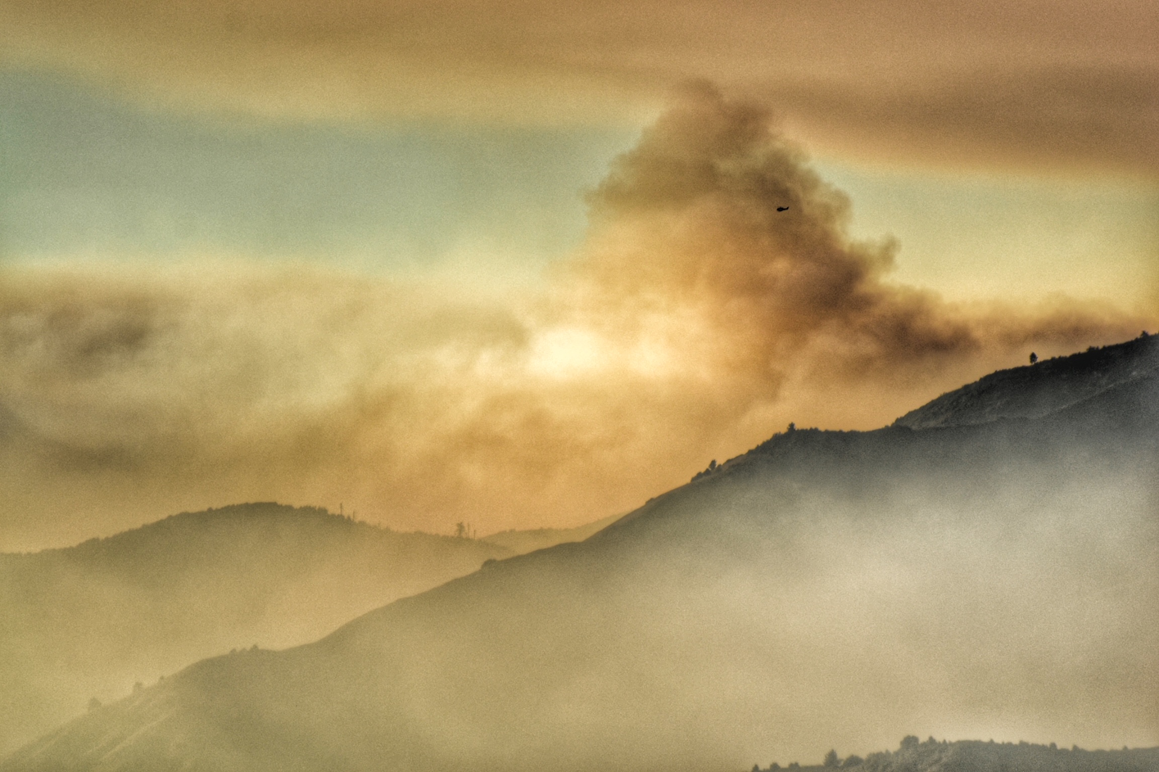
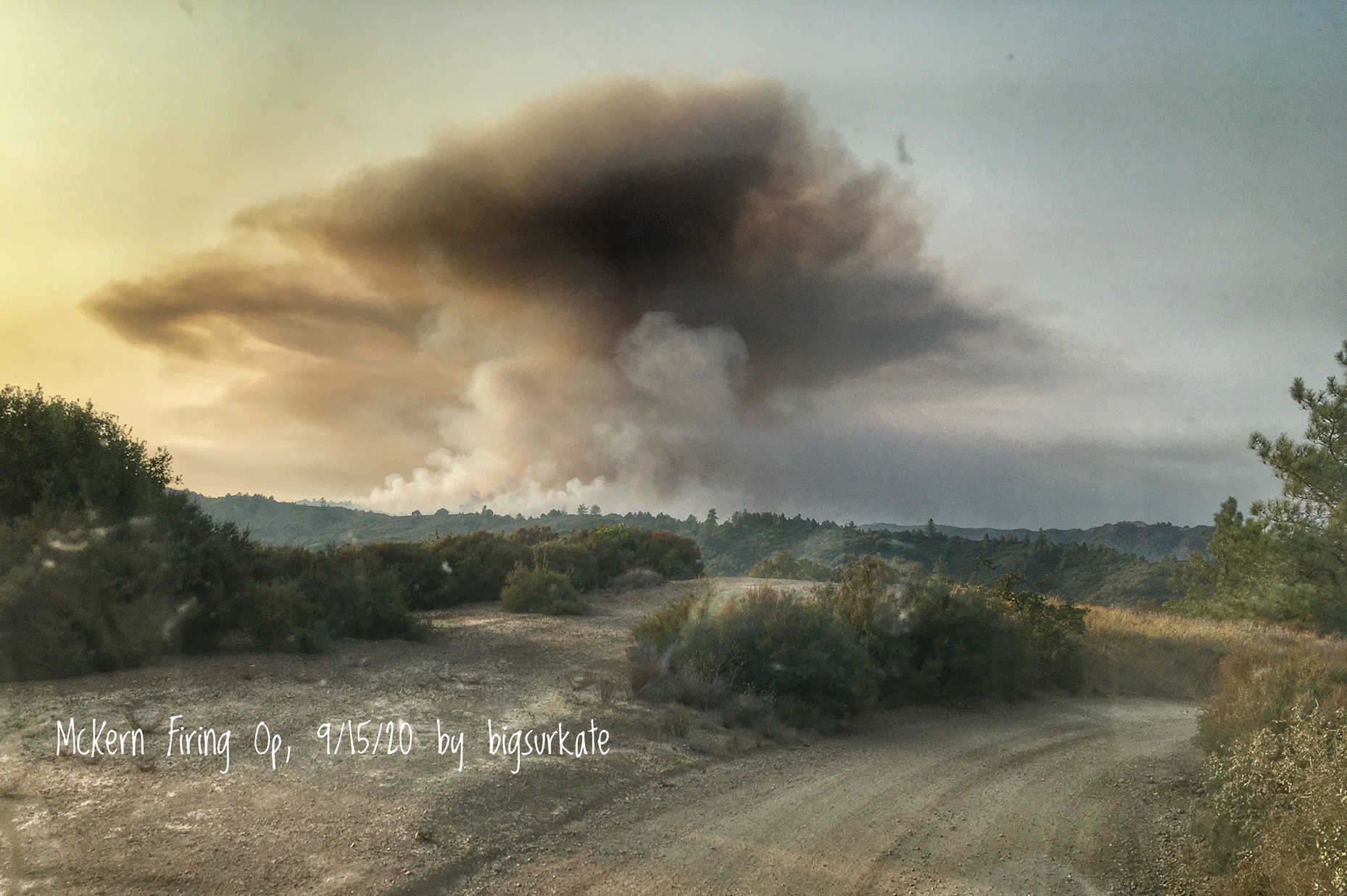
The fires that have shaped our lives this summer are over. The rains finally came, and they were gentle, but our worries are not over. Just like after the Soberanes Fire in 2016, the lives of Big Sur residents will now be dictated by the burn scars, debris flows and road closures which come after a wildfire. This is just the first winter. We will have to be vigilant for several years before there is recovery.
This was on many minds as I started my inquiries of the U.S. Forest Service and Monterey County Public Works Department this past week. There is a strong likelihood that Big Sur will be divided into islands for a time — how many islands and for how long is anyone’s guess.
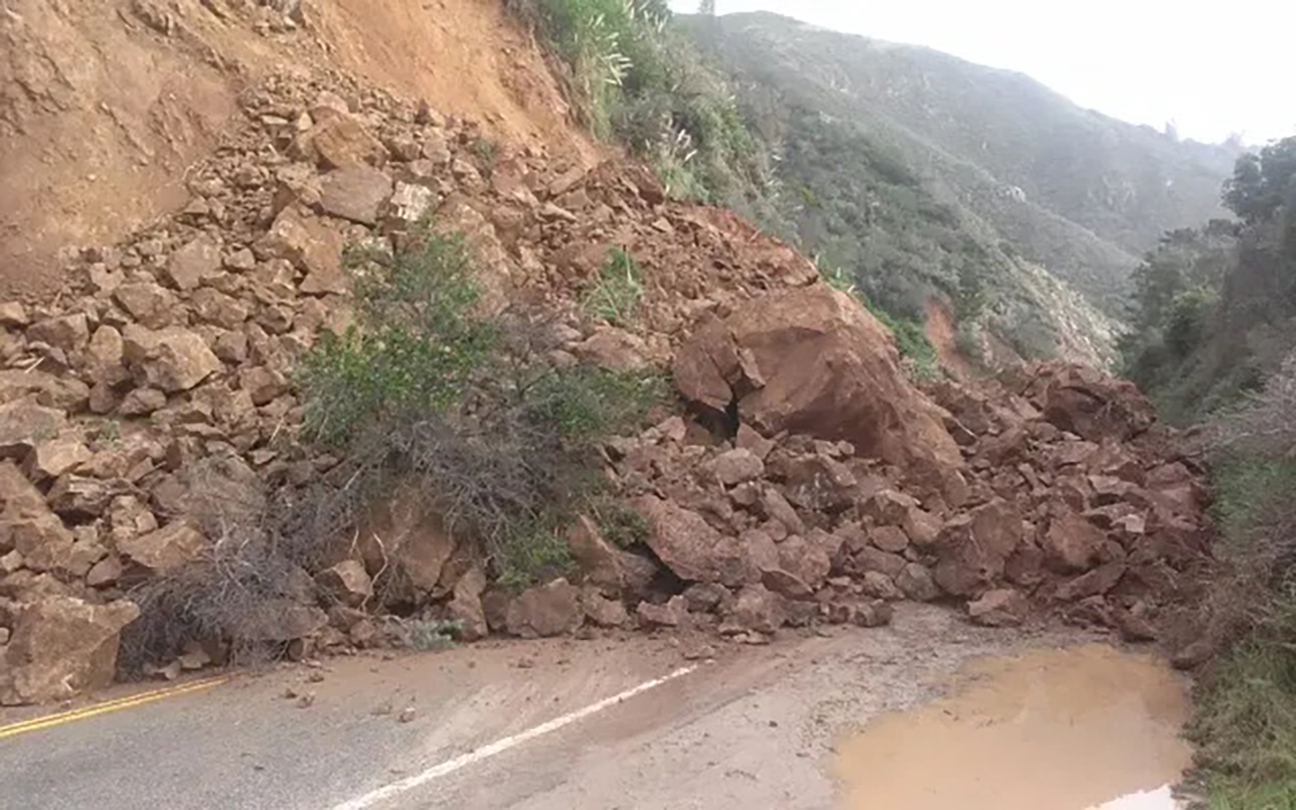
The difference this time is that Nacimiento-Fergusson has always been a back-up way to get off the “island” if one could get to it. This time, that is not likely to be the case. It was easier to close Highway 1 preemptively, if necessary, at Paul’s Slide, if Nacimiento and the rest of Highway 1 were open. This year, one of the worst areas to be hit by fire was from the summit of Nacimiento to the Fort Hunter Liggett boundary. I haven’t driven it, but other locals have. They’ve posted photos to social media or described it to me, and they all said the same thing. It looks like a moonscape back there.
Enlarge
A resident called me last week after hearing from a reliable source that there were plans afoot to put concrete barriers on Nacimiento Road. I needed to understand what was planned for myself and for my community, so I contacted my various sources at the roads division at Monterey County Public Works and the USFS to determine what this meant.
Timothy Short, district ranger for the Monterey Ranger District of the Los Padres National Forest, clarified that while Nacimiento-Fergusson Road is a forest service road, “Monterey County has primary … maintenance and management responsibilities, including equipment and staff, and will be monitoring winter storm impacts, and responding as necessary.”
Monterey County Public Works Director Randell Ishii informed me that discussions had been ongoing between his department, USFS and CalTrans to plan for possible impacts on the roads due to the Dolan Fire.
“A multi-agency team has been reviewing the aftermath of the Dolan Fire, ranging from Monterey County OES (Office of Emergency Services), to other County departments, to the USFS, etc.” Ishii said. He said the county only recently received a Burn Area Emergency Response report from the federal government. The report, referred to as BAER, provided data about the damage caused by the fire.
That report only included damage done to Forest Service land on the South Coast, so the county OES is “working tirelessly to try and find a way to get a separate … report investigated and prepared for the lands outside the forest,” Ishii wrote in an email.
Enlarge
The problems wildfires cause are complex. The obvious ones are severe loss of vegetation, soil erosion and possible flash flooding. The report from the feds attempts to address emergency stabilization of these problems, in order to protect public safety, to prevent further degradation of the landscape and to mitigate post-fire damages to cultural resources.
Generally, specialists in soils, hydrology, geology, engineering, wildlife, botany and archeology assess and predict the post-fire effects. Each specialist brings a unique perspective to help the team determine whether the post-fire impacts constitute urgent threats to human life property, or to critical natural and cultural resources. A plan is then created to respond to those threats.
Typically, Cal Fire prepares the report to study impacts and develop a plan for property outside the Forest Service land, as it did for the Thomas Fire in Santa Barbara. That fire started on December 4, 2017, and the significant debris flows started on January 9, 2018.
During the Thomas Fire the two teams formed to evaluate watershed impacts that could threaten life, property, and cultural and natural resources.
In early January 2018, the two teams were still in the early stages of their assessments as a major storm system approached Santa Barbara County. Because it would take weeks or months for both teams to complete their official reports, the county combined preliminary information gathered by the teams with historic data to prepare for the debris flows that the storms would cause.
Most of us will remember the devastating videos of the debris flows from the sloping terrain destroyed in the Thomas Fire in the the Transverse Ranges in Santa Barbara and Ventura counties. Per Cal Fire, the fire burned 281,893 acres, with full containment declared on Jan. 12, 2018. A total of 1,063 structures were destroyed across both counties, and 280 additional structures were damaged.
Post-fire debris flows started at approximately 3:45 a.m. on Jan. 9, 2018, starting first in the Santa Ynez Mountains and then spreading eastward to watersheds in the Topatopa Mountains. Within the Montecito and Carpinteria area, the debris flows traveled from the canyon mouths on to urbanized areas extending about 2.5 miles to the Pacific Ocean. The debris flows killed 23 people, destroyed over 130 homes, and caused severe damage to infrastructure.
Enlarge
As one can tell from the information we have on the Thomas Fire, information gathering by various agencies are often not completed until months after a fire is contained. What is available is the preliminary research and suggestions.
I do not mean to imply that our debris flows will be anything like the Thomas Fire this winter. Even though we have had significant debris flows in the past, this winter is not expected to be as wet as the one in 2017. Some of the areas that created problems then may create problems again, as some of the same areas burned four years ago in the Soberanes burned this year in the Dolan — Anderson Creek is just one example.
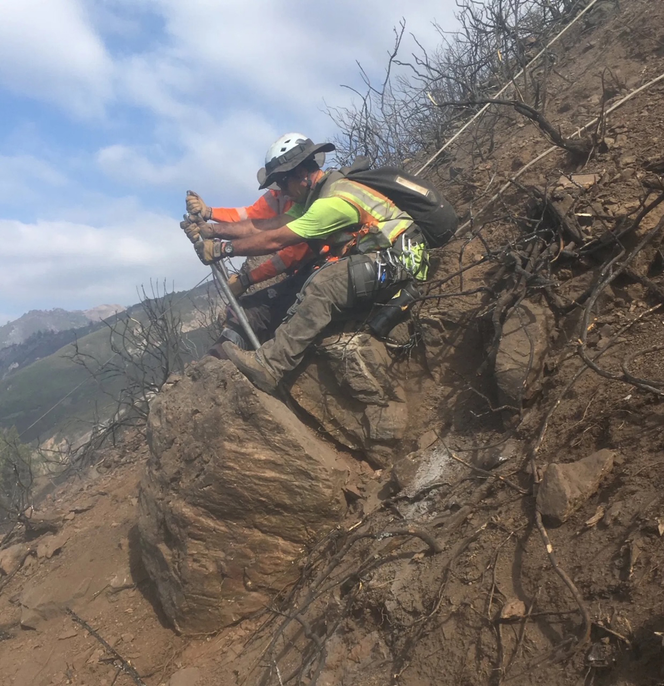
Tim Short, the district ranger, said that he and the Burned Area Rehabilitation Team have reached out to county officials to discuss post fire effects on this road, and potential support to address winter storm road impacts.” The Forest Service has taken proactive steps to clear culverts, install debris fencing to prevent plugged drainage inlets, contract culvert riser installation, and remove hazard trees among other activities,” Short said in an email.
In another email Ishii said his county department is evaluating methods available to keep Nacimiento-Fergusson Road open. “However, we must acknowledge that should the storms be greater than our capacity, there is (a) possibility that the road would need to be closed for public safety,” he wrote. “(T)his would be after coordination/concurrence by the USFS.”
Road closure information will be updated on the county’s website and on my blog.
Ishii also said the county learned several weeks ago that the Caltrans does not expect to preemptively close Highway 1 at Paul’s Slide and Mud Creek, as it has in the past when conditions are dicey. The area of Paul’s Slide was subject to some significant burning above it and around it at the Hermitage, so even though CalTrans does not intend to close it preemptively, Mother Nature may have other plans.
Enlarge
What does all this mean for those of us who live down here and rely on these roads to get to work, school and town to restock for the winter? The biggest “wrinkle” in our planning will be Nacimiento. Hopefully, Mud Creek will not give way and the road will remain open to the south, but I don’t have much confidence in the road to the north nor to the east.
Most of us stock up on supplies for the winter, probably much like those who live in heavy snow country do. One of our residents managed to secure a grant and get a supply of dried prepared food for the community a couple years ago. It is safely stored against the elements. We already know we can be stuck. Most of us hopefully are ready for that.
It is easy to stock up for a month. Two might be pushing it for items we need for comfort — propane, gasoline and the like. Three months and we will definitely start running out of some important supplies.
Beyond that? Well, I am stocked up on firewood, lamp oil and wicks, if I need them, and books — I have my winter book stash in pretty good shape. I might be limited with my internet if I run out of gasoline for my backup generator, but otherwise I am pretty well prepared.
I can hibernate pretty well, if I need to … I hope. But then again I also hope I don’t have to.
Note: Monterey County is hosting a webinar to provide an update on Post-Fire Winter Storm Preparedness for communities impacted by the 2020 Wildfires at 5:30 p.m. Nov. 18. Officials say the presentation will address the winter storm outlook, flash flooding/debris flow/mudflows, preparing your home, insurance, alert and warning, precipitation thresholds, evacuation zones, etc. Panelists will include representatives from the National Weather Service, the National Resource Conservation Services, the Monterey County Resource Management Agency, the Water Resource Agency, and the Office of Emergency Services. To participate, go to https://montereycty.zoom.
![]()
Have something to say about this story? Send us a letter.
SUPPORT NONPROFIT JOURNALISM ![]()
GET OUR FREE WEEKLY NEWSLETTER![]()